

The Fundamental Trade-Off: Speed vs. Accuracy in Reality Capture
Every surveyor knows the struggle! You need data that’s both fast to capture and accurate enough to trust. On-site, the clock is always ticking, but so is the demand for precision that downstream BIM, CAD, and construction workflows rely on.
Balancing those two goals is the most important aspect of reality capture.
That’s where two powerful laser scanning technologies come into play:
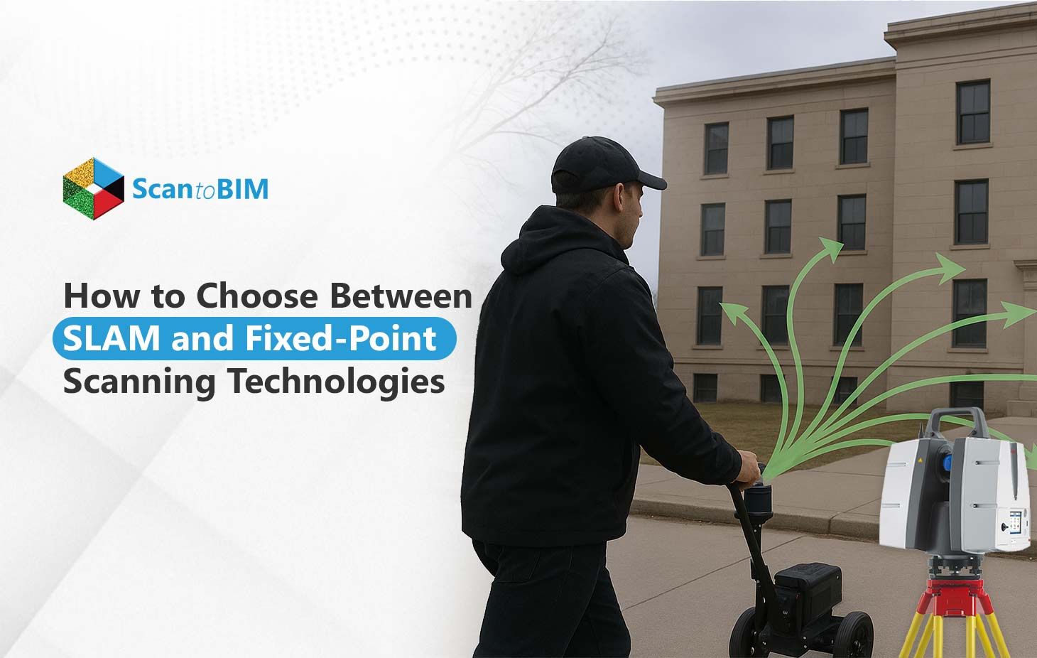
- SLAM (Simultaneous Localization and Mapping): A mobile, walk and scan solution that captures reality in real time.
- Fixed-Point or Terrestrial Scanning: A tripod-based, high-accuracy technology that records every detail from static positions.
Choosing between them isn’t about which is “better”; it’s about understanding your project’s priorities, such as speed, accuracy, specifications, etc., and selecting the tool that gets you the best results where it matters most.
Let’s Understand the Two Technologies - SLAM and Fixed-Point Scanning
Every surveyor has been in a similar scenario, standing in the field and being asked, “Are we using the tripod or the mobile scanner today?”
The answer depends on your comprehension of both technologies and how they align with the respective project objectives. Both Fixed-Point Scanning and SLAM are designed to capture in 3D existing real-world spaces; however, they take remarkably different attempts to realize that goal.
What Is Fixed-Point Scanning?
Fixed-point scanning (also referred to as terrestrial laser scanning (TLS)) is the older and more precise method. The laser scanner is mounted to a tripod and captures millions of laser points from a single stationary location.
The end result is a dense and highly accurate Point Cloud to BIM Conversion Services of all surfaces in view.
- How it works: The scanner sends out a laser beam that reflects off the object and measures the time taken for the light to return to the sensor, allowing it to determine distance with millimeter accuracy.
- Why it is important: Fixed point scanning is ideal for work wherever millimeter matters, such as in heritage preservation, industrial plants or surveys of building facades or structural deformation surveys.
- Equipment tools: The most common scanners in the field come from Leica (RTC360), Faro (Focus), or Trimble (X7).
- Workflow in the field: Because the laser scanner only captures part of a site during a single setup, surveyors will usually perform a number of setups and register those setups later in the office to make one model.
Yes, this process is slower than mobile scanning methods, but for methods of surveying where accuracy and reliability matter, fixed point scanning methods are always the best choice.
What Is SLAM Scanning?
If fixed-point scanning is all about precision, SLAM (Simultaneous Localization and Mapping) is about speed and mobility. Thanks to this technology, you can walk and scan spaces seamlessly with a handheld, backpack, or mobile mounted LiDAR device.
- How it works: SLAM technology utilizes LiDAR sensors, camera systems, and inertial measurement units (IMUs) to track your movement and map the environment in real-time - without GPS.
- Why it is popular:
- Cuts field time exponentially; often 5–10× faster than tripod options.
- Navigates complex multi-level or hard-to-access areas easily.
- No or limited set-up; just turn it on, commence walking, and the system does the rest for you!
- Devices you will see in the field: GeoSLAM ZEB-series, NavVis VLX, and Leica BLK2GO are major players.
The power of SLAM is its efficiency and flexibility. Even though you sacrifice some accuracy for speed, SLAM is ideal for surveyors operating at larger facilities, tunnels, and fast-paced construction sites where the coverage as a whole is more important than precision on all points.
Both technology alternatives have their own benefits, and if a surveyor uses both, they can get the best of both. A professional gets the precision of fixed-point scanning and the agility of SLAM.
When to Use Fixed-Point Scanning vs. SLAM Scanning
| Criteria | Fixed-Point Scanning | SLAM Scanning |
|---|---|---|
| Best For | Projects that demand high precision and detailed geometry | Projects that require speed, mobility, and large-area coverage |
| Typical Use Cases |
|
|
| Accuracy Level | Millimeter-level precision | Slightly lower accuracy (centimeter range) |
| Data Capture Method | Stationary, tripod-based scans from multiple fixed points | Continuous mobile mapping while walking or moving |
| Key Strengths |
|
|
| Limitations | Time-consuming fieldwork and setup | Lower precision and potential drift over long distances |
| Ideal Project Scale | Small to medium projects with tight tolerances | Large or complex sites where quick turnaround is essential |
Key Differences Between SLAM and Fixed-Point Scanning
Initially, it might seem like SLAM and fixed-point scanning serve the exact purpose — to document the built environment in 3D. However, surveyors know on the field, it's not simply the case. Both technologies utilize different principles, and oftentimes you are left with balancing speed, accuracy, and practicality when determining the best approach.
Accuracy
When accuracy is critical, the obvious choice is fixed-point scanning. A fixed-point scanner, which is set up on a tripod and is a static tool, can provide millimeter accuracy necessary for industrial plants, documentation of facades, or structural analysis. SLA, on the other hand, provides slightly less accuracy (within 1-3cm); however, more than an accurate enough approach for as-built modeling, interior mapping, or progress tracking and all 3 applications are ideal for SLAM scanning, especially when time is limited.
Speed
SLAM scanning wins the race when a timeline is present. SLAM, especially the way you can walk and scan continuously, can be 5-10x faster, whereas fixed-point scanning requires you to be thoughtful with your stations and careful in aligning; slower, methodical, but super reliable.
Data Density
Fixed point scanners produce more complex, high-density point clouds that represent every detail of the surface. SLAM produces fewer points, but captures a lot more area in much less time.
Mobility
SLAM provides surveyors true freedom of movement. It is ideal for using in hallways, stairs, or underground areas. Fixed point systems are tethered to the tripods, so they require frequently moving it into a vertical position or rotating them for complete coverage.
Environment Suitability
SLAM functions efficiently in cluttered, complex, or GPS-denied environments, while fixed-point scanning functions very well in controlled environments, with an emphasis on total accuracy and resolution.
In practice, most practitioners use both fixed point scanning for datasets that require higher precision and total stationary scan coverage, and SLAM for areas where general coverage is more important. This creates a workflow that is fast, flexible, and reliable.
Can You Combine SLAM and Fixed-Point Scanning?
In reality, the optimal outcome frequently stems from combining SLAM Technology in 3D Laser Scanning Services and fixed-point scanning methods together. Numerous surveys and BIM companies are now moving toward this hybrid process to get both accuracy and speed during Point Cloud to BIM Conversion work phases.
- Fixed-point captures provide the anchor of accuracy, high-density reference data that guarantees every item is located correctly.
- SLAM scanning brings in speed and coverage, allowing for the imaging of large, complicated, or hard to reach areas where setting up a tripod may not be feasible.
By combining both datasets, surveyors can produce complete, high-quality point clouds that balance accuracy with productivity, an excellent option for multi-phase or large projects where time is limited but accuracy needs to be maintained.
Final Thoughts: Choosing the Proper Tool for the Appropriate Project
Both SLAM and fixed-point scanning have proven their relevance in modern surveying and there is no single solution. The best option depends on the project goals, accuracy, and efficiency. Knowing when to diverge decision-making between accuracy and speed is crucial for the quality of your Point Cloud to BIM Conversion.
Selecting the right scanning methodology is not only productive when assuring accurate digital twins, but it also fosters a smooth project workflow from the field to the model.
