 +1 (409) 247-5496
 +61 468 036 171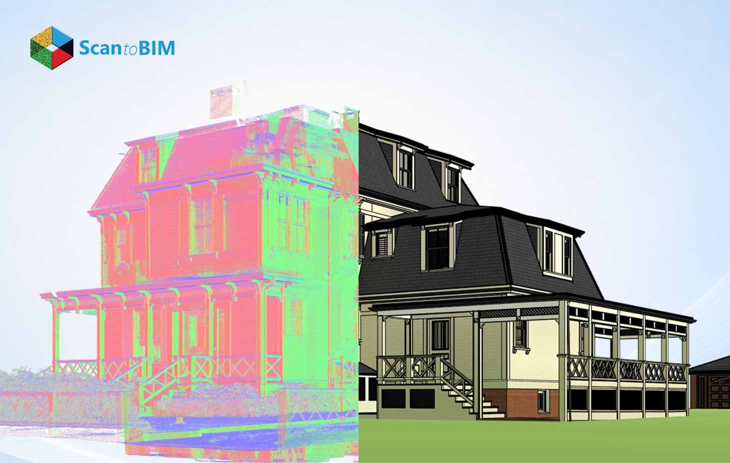
Construction teams demand exact spatial records before they renovate or extend a building. Laser scanners answer this demand. They capture millions of measured points within minutes. Skilled modelers then convert this raw spatial data into intelligent digital models. The result guides every design decision with verified geometry.
This article explains the full conversion journey from scanner to delivered model. It covers the underlying technology and the complete workflow. It also examines accuracy factors alongside provider selection criteria. Field notes from live project audits support every section.
What Is Point Cloud Data and Why Is It Essential for BIM?
A point cloud is a large set of measured points in three-dimensional space. Each point carries X, Y, and Z coordinates. Many scanners also record color values plus reflection intensity. Together, these points form a digital replica of a physical structure.
3D laser scanning produces this data through LiDAR sensors. The scanner emits laser pulses toward every visible surface. It measures the return time of each pulse. This calculation fixes the exact position of every surface element. A single interior setup records several million points in under two minutes.
Why do point clouds matter so much for BIM? Old drawings tell yesterday's story. Walls move over the decades, and paper archives miss those changes. Tape measures add their errors across long distances. A fresh scan shows the building as it stands on capture day. Providers of Scan to BIM services then shape that field truth into working models for design teams.
What Are As-Built BIM Models?
An as-built model represents a structure exactly as it stands today. It differs from a design model in one core way. A design model shows intent. An as-built model shows constructed reality.
Modelers build these deliverables inside BIM platforms such as Autodesk Revit. Each element becomes an intelligent parametric object. A wall object stores its thickness together with material data. A duct object stores its actual elevation and system assignment. Teams attach asset metadata for facility operations. As-built documentation then grows from the model into coordinated plans and sections.
Practitioners define detail through Level of Development grades from the BIM Forum specification. LOD 200 supports space planning. LOD 300 supports design coordination. LOD 400 supports fabrication-level output. The USIBD Level of Accuracy framework adds measured tolerance grades to each deliverable.
Why Accurate As-Built BIM Models Matter in Construction and Facility Management
Accuracy protects budgets at every project stage. Wrong geometry causes clashes during installation. Clashes trigger change orders. Change orders inflate cost and delay schedules.
Peer-reviewed evidence backs this assertion up. One study in the journal Discover Materials measured the effect across several case projects. Design errors fell close to 30 percent under BIM. Requests for information dropped by roughly a quarter. Fewer questions from the field mean fewer change orders on the ledger.
Handover teams feel the payoff too. Picture a maintenance crew hunting for a shutoff valve above a hospital corridor. An accurate model points them straight to it. Architects planning a refit trust those wall positions from day one. Firms offering As-Built BIM Modeling Services deliver this verified accuracy as a contractual outcome backed by deviation reports.
When Should Point Cloud Data Be Converted into an As-Built BIM Model?
Renovation projects head the list. Designers need true geometry before demolition planning starts. Heritage conservation follows closely. Historic structures lack usable drawings in most cases.
Facility handover marks another clear trigger point. Owners increasingly want a verified digital record at closeout. Existing Conditions Modeling also earns its keep in lease planning across commercial portfolios. Plant retrofits call for fresh scans ahead of big equipment swaps. Even insurers now ask for current records after structural incidents. Early conversion prevents costly surprises during construction.
Step-by-Step Process: How Point Cloud Data Is Converted into Accurate As-Built BIM Models
The workflow follows six controlled stages. Each stage feeds verified data into the next. A quality gate closes every stage before the next one opens.
Step 1: Site Scanning and Data Capture
Good fieldwork starts on paper. Surveyors sketch scan positions long before anyone unpacks a tripod. Terrestrial scanners then cover interiors from overlapping setups. Drone photogrammetry covers roofs plus tall facades. Control targets tie every setup to one shared coordinate system.
As an auditor on a recent hospital retrofit, I walked the floor plate after every scan session. This habit exposed two blind corners behind mechanical risers. Extra setups on the same visit removed both gaps. Field verification during the capture stage takes only a few minutes. A return mobilization costs days.
Step 2: Data Cleanup and Noise Removal
Technicians import raw scans into software such as Autodesk ReCap or Leica Cyclone. Point cloud processing removes noise from moving people and passing vehicles. Filters delete stray reflections from glass or polished floors. The team then thinks of redundant points to control file size.
Step 3: Scan Alignment and Unification
This is the critical stage. Point cloud registration stitches separate scans into one shared dataset. The software matches overlapping geometry between neighboring setups. Target markers then confirm each alignment mathematically. A registration report states the mean error figure for the whole job.
Auditors verify these reports against a defined tolerance. Tight commercial projects hold registration errors to under three millimeters. Infrastructure projects accept wider bands across long corridors. That verified report travels with the delivery package. Clients get the means to audit our accuracy claims on their own terms.
Step 4: Model Creation in BIM Software
Modeling is where craft becomes important. We link the registered cloud into Revit as a locked reference and start tracing. Structural grids come first. Walls follow. Floors plus roofs come next. MEP elements round out the geometry in system order.
Point cloud modeling demands trade-specific judgment at this stage. Pipe runs need correct system classification. Ducts need true installed elevations. Cable trays need accurate widths for future capacity planning. Experienced modelers resolve occluded areas through timestamped field photos. I insist on one habit here. Each assumption goes into a running issues register with a photo reference attached.
Step 5: Quality Assurance and Accuracy Verification
QA teams overlay the finished model against the source cloud. Deviation analysis colors every surface according to its distance error. Reviewers inspect these heat maps section by section. Elements outside tolerance return to the modeling team for correction. A second auditor signs the final deviation report. Two-person verification protects clients from single-reviewer oversight.
Step 6: Delivery and Documentation
Delivery day feels routine when the process holds. We export the approved model in native RVT along with open IFC. Sheet sets carry the plans and elevations that permit reviewers expect. A short BIM execution record spells out naming rules plus LOD grades per ISO 19650. The source cloud ships alongside the model so future auditors can retrace our steps.
Key Factors That Affect the Accuracy of As-Built BIM Models
Accuracy has many parents. Four factors decide whether a model earns trust or gathers dust. Seasoned surveyors check these first.
- Scan resolution: Tight point spacing captures small pipes and conduit. Sparse spacing hides them behind measurement gaps.
- Registration quality: Alignment error propagates through every modeled element. A five-millimeter registration drift becomes a five-millimeter wall error.
- Tolerance agreements: Teams fix deviation limits before modeling starts. A documented Scan to BIM workflow keeps every stakeholder aligned with these limits from day one.
- Hardware capability: Survey-grade scanners hold accuracy across long ranges. Consumer devices drift beyond short distances. Human skill decides the outcome. Trained modelers interpret ambiguous geometry correctly.
Weigh these factors together rather than in isolation. A strong scanner paired with a weak process still produces weak models.
Common Challenges in Point Cloud to BIM Conversion and How to Overcome Them
Every conversion project hits friction somewhere. Each common obstacle already carries a proven fix. Five patterns keep appearing across the project survey.
- Occlusions top the challenge list. Furniture blocks scanner lines of sight. Teams solve these issues through extra scan positions plus reference photography.
- Large file sizes slow standard workstations. Teams split clouds by building level. They also thin redundant regions before modeling starts.
- Ambiguous geometry complicates laser scan to BIM conversion inside cluttered plant rooms. Experienced modelers cross-check field photos against the cloud before they commit any element.
- Data gaps appear across reflective glass or wet surfaces. Supplementary total station measurement fills these gaps with surveyed points.
- Deadline pressure invites modeling shortcuts. A staged QA gate at every milestone protects quality under schedule stress. Process discipline beats heroic rework every single time.
Most of these fixes cost little when planned early. Retrofitting them mid-project costs plenty. Plan for friction before it surfaces on site.
Applications of As-Built BIM Models Across Different Industries
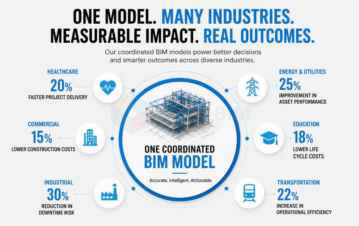
Commercial real estate applies as-built BIM models to renovation design and tenant space audits. Heritage bodies preserve monuments through millimeter-grade digital records. Industrial plants map complex piping before retrofit shutdowns. Healthcare estates track ceiling void services for safe maintenance access.
Researchers at Glasgow Caledonian University tested the approach on a live construction project. Their peer-reviewed case study appeared in the Journal of Engineering, Design, and Technology. The team found that pairing laser scans with BIM curbs rework and shortens completion times.
Bridge owners map aging decks. Tunnel operators chart clearance envelopes. Reality capture services stretch across this whole infrastructure world. Rail operators model stations for accessibility upgrades. Airports squeeze terminal documentation into overnight operational windows.
How to Choose the Right Point Cloud to BIM Service Provider
Review accuracy commitments first. Ask for sample deviation reports from completed projects. Ask which software versions their team actually certifies. Press them about how they secure large file transfers too.
Any provider of point cloud to BIM services worth hiring spells out LOD definitions right in the proposal. Check turnaround capacity against your schedule. Request client references within your sector. Transparent unit pricing signals process maturity. One green flag stands out for me. A provider that hands over its QA checklist unprompted earns my trust fast.
Conclusion
Point cloud conversion turns raw laser measurements into dependable digital assets. The workflow succeeds through disciplined capture and layered quality verification. Accurate models protect construction budgets today. They also serve owners across decades of facility operation.
The core lesson stays simple. Accuracy comes from process control at every stage rather than from any single tool. Choose partners with proven audit records. Your next renovation then starts from a verified reality rather than from assumptions.