 +1 (409) 247-5496
 +61 468 036 171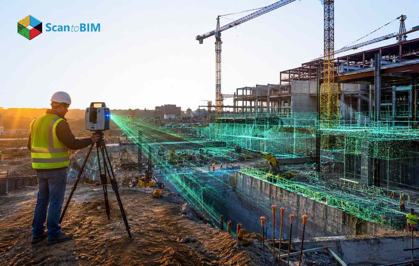
Site conditions never sit still. Drawings from the design phase go out of date the moment a team opens a wall or reroutes a pipe, and that gap between paper and reality is where budgets and schedules start to slip. LiDAR scanning closes the gap. A single pass across a job site records millions of measurements in minutes and turns a guess into a verified digital record of every wall, duct, and grade change on the property. Planners work from that record instead of a set of drawings someone filed years ago, and the payoff shows up in cleaner coordination between trades and earlier hazard identification. Auditors and BIM engineers who spend their days inside scan data notice the same thing project after project: accurate geometry heads off surprises, and surprises are usually where accidents start. This article walks through what LiDAR scanning actually involves, why construction planning leans so heavily on precise site data, and how the technology reshapes safety outcomes from design through closeout.
What Is LiDAR Scanning?
LiDAR stands for Light Detection and Ranging. The system fires rapid pulses of laser light across a surface and measures the time each pulse takes to return. That timing calculation produces a single accurate point in space. A scanner repeats this process millions of times per second, and the collected points form a point cloud, a full 3D record of a structure or site. Terrestrial units sit on a tripod and capture interiors and facades with fine detail. Mobile and wearable units move through corridors and floors quickly while scanning continuously. Aerial units mount on drones and cover large sites or unsafe terrain from above. Firms that offer professional LiDAR scanning services match the scanner type to the project goal, whether that goal centers on interior renovation, site topography, or wide infrastructure mapping. The resulting point cloud becomes the foundation for every downstream planning decision a project team makes.
Why Construction Planning Depends on Accurate Site Data
Construction planning starts with a single question: what already stands on the site? Drawings from years ago often miss additions, repairs, and undocumented utility runs. Planners who trust incomplete drawings build schedules on false assumptions, and those assumptions surface as costly surprises during demolition or excavation. Accurate site data closes this gap early, before contracts lock in a budget or a timeline.
Existing conditions modeling turns raw scan data into a structured record that shows every wall, beam, and pipe in its true location. Design teams overlay new work onto this model and spot conflicts long before construction starts. Schedulers use the same model to sequence trades around real obstacles instead of guessed ones. Years later, owners still pull from that same dataset for maintenance planning. Get the data right at the front end; budgets, schedules, and worker safety all benefit for the life of the project.
How LiDAR Scanning Improves Construction Safety
Construction remains one of the most dangerous fields for American workers. Federal labor data shows the industry employs about 6 percent of the national workforce. It accounts for over 20% of worker fatalities nationwide. Several of the root causes behind those numbers trace back to bad or missing site information, and LiDAR scanning attacks that root causes problems directly. A surveyor stands at a safe distance and records data instead of climbing an unstable structure or crawling into a confined space with a tape measure. The scan itself picks up uneven terrain, shifting grade, and buried utility conflicts, so it flags hazards on a screen before anyone walks near them.
From there, the data goes to work in daily planning. Superintendents pull hazard maps built from construction laser scanning services into morning meetings and route foot traffic and equipment around the riskiest zones. Rescan a site partway through a build, and small shifts in structural elements show up early, sometimes weeks before a problem would otherwise surface. Safety teams treat these scans as one more check layered on top of the walkthroughs they already run, and teams on projects that adopt the practice tend to report fewer near misses once hazard mapping becomes part of the weekly routine.
Key Benefits of LiDAR Scanning for Construction Projects
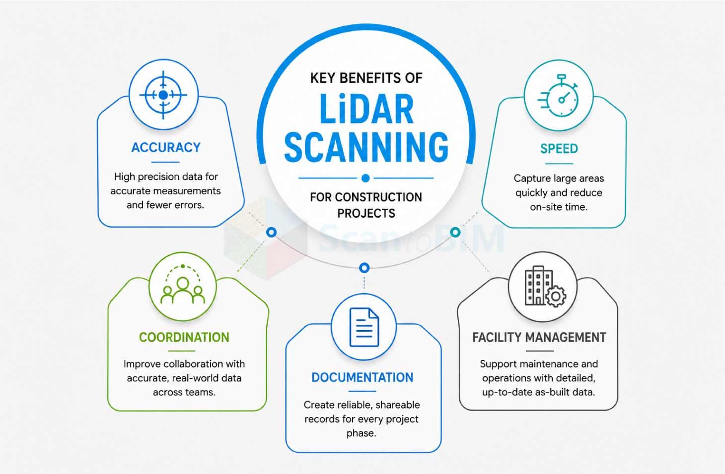
LiDAR scanning pays off in several areas at once, and the benefits build as a project progresses.
- Accuracy: Scanners hold geometry to within a few millimeters, well past what a tape measure can promise on a busy site.
- Speed: Work that used to take several days of manual measurement now wraps up in an afternoon.
- Coordination: The system catches clashes on a screen rather than during installation, as architectural, structural, and MEP models sit on top of real geometry.
- Documentation: Each scan leaves behind a timestamped record, which is useful when a dispute over installed work arises.
- Facility management: Long after the ribbon cutting, owners still have an accurate digital record to plan renovations and repairs against.
Firms that build full 3D laser scanning services around this workflow carry a client from field capture through the finished model without handing the file off between vendors. Teams that lean on this approach tend to report fewer disputes and tighter schedules, and a scan paid for once often gets reused across survey, design, fabrication, and verification work.
LiDAR Scanning vs. Traditional Surveying Methods
Traditional surveying uses total stations and manual stakeouts to record selected points across a site. Skilled teams still deliver solid results with this approach, and it remains the standard for setting legal control points. The catch is coverage. A total station records isolated points rather than a full surface, so gaps tend to open up in complex or crowded areas. LiDAR does not have that limitation, since one pass across a site captures every visible surface and produces a complete geometric record instead of scattered samples. Rescanning for a progress check takes an afternoon rather than a fresh survey trip. Many firms now run both methods side by side. LiDAR scanning for surveying firms adds speed and coverage on top of traditional control work, so experts spend less time on site while walking away with more usable data, and the resulting hybrid workflow keeps legal survey accuracy intact while giving planning teams the full geometric picture they need day to day.
| Factor | LiDAR Scanning | Traditional Surveying |
|---|---|---|
| Coverage | Full 3D capture of every surface | Selected points only |
| Speed | Hours for a full level | Days of manual work |
| Accuracy | A few millimeters | Depends on operator skill |
| Repeatability | Rescan anytime for progress checks | Hard to reproduce exact points |
Common Challenges in Construction Planning and How LiDAR Solves Them
A handful of problems show up on almost every project, and scan data addresses each one in a different way.
- Missing or outdated drawings: Older buildings scheduled for retrofit work often come with drawings that stopped matching reality years ago. LiDAR scanning for renovation projects fixes this issue and ensures that architects design based on the actual conditions present, rather than relying on outdated floor plans that may not reflect the current state.
- Clash detection: MEP, structural, and architectural teams working in isolation from each other tend to design straight into conflicts. Point clouds put every discipline on the same accurate geometry, so a duct that would have collided with a beam is caught on screen weeks before anyone would have discovered the problem on site.
- Change orders: Money and schedule risk pile up fast once a change order lands mid-build. A study looked at this issue directly and found BIM adoption improved coordination while cutting change volume somewhere between 6% and 47% across the projects reviewed. Wide range, sure, but the direction holds across every project in the study.
Pair LiDAR capture with a structured BIM workflow, and a team tends to land toward the higher end of that range rather than the lower one.
How Scan to BIM Converts LiDAR Data into Actionable BIM Models
A raw point cloud is worth a lot, but it is still just a cloud of coordinates until someone processes it. Point cloud to BIM conversion is the step that turns millions of unstructured points into organized elements, including walls, beams, ducts, fixtures, and everything else. Modelers register the overlapping scans, strip out noise, and align everything to project coordinates before any modeling starts. From that cleaned dataset, they build parametric BIM elements at whatever level of detail the project calls for, and architects and engineers open the finished model straight in Revit, Navisworks, or a similar platform to start coordinating.
Every conversion gets checked against its source. Modelers pull the finished model back up next to the original point cloud and confirm the dimensions line up. This process catches errors before they travel downstream into design. Specialized Point Cloud to BIM services scale this process across an entire building portfolio, ensuring that a firm managing dozens of floor plans still receives consistent output. Contractors who end up with both the point cloud and the finished model keep a clean trail from field capture to final design, and that trail keeps paying off years later when a renovation project needs the same building again.
Why Choose ScantoBIM.Online for LiDAR-Based BIM Services
A Scan to BIM company is only as good as the fieldwork behind it. ScantoBIM.Online runs terrestrial, mobile, and aerial scanners on site, then registers and processes each dataset through a quality check before a modeler ever opens the file. From there, an AI-powered workflow takes over much of the heavy lifting automatically fitting walls, doors, windows, floors, and topography directly from the point cloud data. This cuts manual effort by up to 50% and speeds up delivery by roughly 30%, without sacrificing precision. The modeling team then builds coordinated architectural, structural, and MEP elements at whatever level of detail a project calls for, from schematic design straight through construction documentation. Every model passes through an automated QC tool that checks 100+ parameters, so what reaches the client meets a consistent, verified standard of accuracy.
Renovation clients get as-built BIM modeling services that document existing conditions down to the detail, so design decisions rest on verified geometry rather than a set of plans nobody trusts. Clash detection reports, quantity takeoffs, and facility management datasets round out what owners walk away with, and most of them keep using the model long after the project closes. Turnaround stays fast, communication stays direct, and we do not skip quality control just because a schedule is tight.
Conclusion: Building Safer Construction Projects with LiDAR Scanning
LiDAR scanning changes the mechanics of how a construction team plans, coordinates, and looks after its workforce. Accurate site data pulls guesswork out of early design decisions and gives every discipline the same source of truth to work from. Hazards surface on a screen before a team ever reaches them, and surveyors stay clear of the dangerous zones they used to walk straight into. Conflicts get caught in a coordinated model instead of on the job site, and every scan leaves behind a record that settles disputes, guides maintenance, and feeds future renovation work. None of this eliminates surprises entirely, but firms that build LiDAR into their planning workflow see fewer of them and steadier outcomes across every project phase. Site conditions will continue to shift. The teams that capture them accurately are the ones that keep building safer projects on schedule and within budget.