 +1 (409) 247-5496
 +61 468 036 171
Delivering Accurate 3D Laser Scanning Services Globally
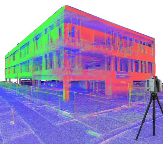
We scan buildings and infrastructure for architects, engineers, and contractors who need precise site data before design begins
We Are A Part of Their Success Story
Leading architects, engineers, and contractors rely on our reality capture services for consistent high-quality project outcomes.



Accurate 3D Laser Scanning Services for Every Job Site
Every project depends on accurate site data and our 3D laser scanning services give your team that starting point across the USA, UK, Canada, Australia and other countries.
Site conditions almost never match the drawings on file. Buildings settle, additions go undocumented, and tape-measure surveys miss small details. Teams that skip proper laser scanning surveying end up designing around guesswork. That guesswork surfaces later, during construction, as clashes, change orders, and site revisits nobody budgeted for.
Join Our Worldwide Scanning Network
We partner with laser scanning companies across the USA, UK, Canada, Australia and other countries to deliver consistent, high-quality projects for AEC clients nationwide.
- Steady stream of qualified scanning projects, no lead generation needed
- Fast, reliable payment on every completed job
- Nationwide project referrals across architecture, engineering and construction clients
- Flexible scheduling that works around your existing crew
- Long-term partnership, not one-off gig work
- Dedicated point of contact for every project you take on
What You Get with Our Point Cloud Laser Scanning Solution
Millimeter-accurate point cloud laser scanning of any site
Nationwide field crews using top-rated laser scanners
Free quotes ready within 24 hours
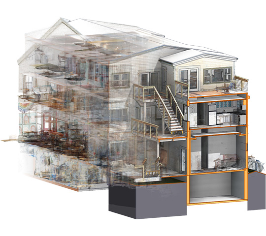
Data ready for Scan to BIM or Scan to CAD
Registered, cleaned point clouds, not raw, noisy files
Support for 3D laser scanning in construction, renovation and design work
Laser Scanning Options Built Around Your Project
Different sites call for different equipment, so we match the right laser scanner to your building, terrain and project timeline.
Terrestrial Laser Scanners (TLS)
Tripod-mounted scanners for high-detail interior and exterior capture
Handheld Laser Scanners
Portable capture for tight spaces and fast walkthroughs
Mobile & Airborne Scanning (SLAM Technology)
Continuous capture while walking or driving through large sites
Drone-Based or Aerial LiDAR Scanning
Aerial capture for rooftops, terrain, and large open sites
Time-of-Flight (ToF) Laser Scanners
Long-range scanning built for large facilities and open sites
Phase-Based Laser Scanners
High-speed, high-density capture for detailed interior work
Ready to Get Accurate 3D Laser Scans of Your Site?
Fast to schedule, easy to start and backed by a worldwide vendor network, so accurate site data is never far away.
From Site Visit to Point Cloud in 4 Simple Steps
Getting accurate scan data does not need to be complicated, so we keep our laser scanning process simple and transparent.
Site Assessment & Scheduling
You share your site details and we schedule a certified crew from our nationwide vendor network.
On-Site Laser Scanning
Our field team captures your site using a terrestrial, handheld or mobile LiDAR scanner, based on scope.
Registration & Cleanup
We align every scan position, remove noise and merge captures into one accurate point cloud.
QA & Final Delivery
We check dimensions with respect to the raw scan and then deliver files in your preferred format.
Where 3D Laser Scanning Fits in Your Workflow
Whatever you are building, renovating or documenting, our laser scanning services adapt to your project type and site conditions.
-6a5b239b55f1c8beacf8c92d449c5ee7.jpg)
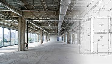
Commercial Real Estate & Tenant Improvements (TI)
Document space accurately for tenant build-outs
As-Built Documentation
Record true site conditions for project records
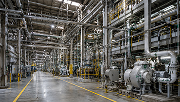
Industrial & Plant Facilities
Map equipment, piping, and structural layouts precisely
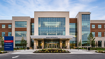
Healthcare & Education Infrastructure
Scan complex facilities without disrupting daily operations

Heritage & Historic Building Documentation
Preserve historic structures with precise 3D records
The Laser Scanners and Software We Work With
Our worldwide vendors bring the equipment used across 3D laser scanning for architecture and construction projects and those are among the most trusted in the industry.


Why AEC Teams Choose Our Laser Scanning Company
Plenty of 3D scanning companies own scanners. Few pair that equipment with reality capture services and an in-house team that turns your point cloud into a usable deliverable.
Request a Quote →Frequently Asked Questions
A LiDAR scanner sends out laser pulses and measures how long they take to bounce back. Millions of these measurements form a point cloud which is a precise 3D record of your site.
Our terrestrial and mobile scans meet tolerances required for construction documentation. We verify every deliverable against the raw scan data before it reaches you.
Yes. We work with a worldwide vendor network, so we can schedule certified 3D laser scanning services almost anywhere in the globe.
It depends on the site. Large or open sites often call for mobile or airborne scanning (SLAM technology) while tight interior spaces suit terrestrial or handheld scanners better.
We deliver registered point cloud data in E57, LAS, LAZ, RCP, PTX or any additional formats your project requires.
We provide both. Our point cloud laser scanning services connect directly to our Scan to CAD and Scan to BIM teams, so you get one point of contact from field capture to finished model.
Pricing depends on site size, scan complexity, and turnaround needs. We provide a free, itemized quote within 24 hours of your request.
Related Blogs
Explore laser scanning insights, equipment guides, and reality capture best practices for AEC teams.