 +1 (409) 247-5496
 +61 468 036 171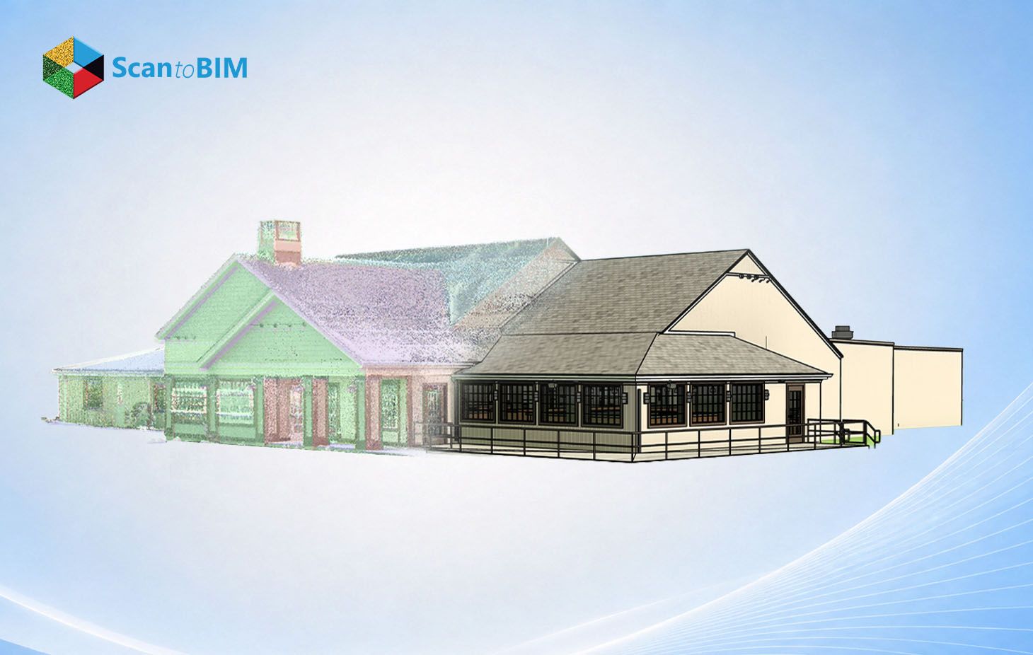
For decades, architects relied on field measurements, legacy drawings, and site observations to understand existing conditions. Old drawings, faded blueprints, and manual tape measurements shaped every renovation decision. A fresh approach clears away that guesswork. Laser scanners and drone cameras now gather millions of data points from a physical site within hours. From that raw data, design teams build 3D models that match the actual physical buildings on the ground. Project teams get reliable site information before design work begins. This shift reshapes how architecture practices plan, coordinate, and hand over buildings across every project type.
Teams that open scan files day after day spot the pattern fast. A project that opens with verified geometry sails through design review with fewer stalled meetings and fewer late corrections. Owners ask sharper questions once they walk a model built from actual site data, and design teams answer with steady confidence. This article walks through the mechanics behind the method, the gains it brings to practice, and the technologies that drive the workflow today.
What Is Reality Capture?
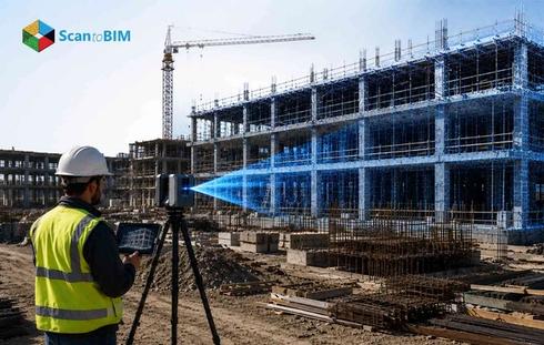
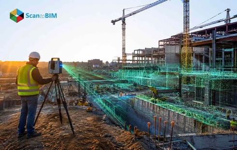
Reality capture records a physical space through 3D laser scanning, photogrammetry, or drone imagery. A scanner fires laser pulses across a room or a facade, then clocks how long each pulse takes to bounce back. Those returns build a point cloud: a dense field of coordinates that maps each surface, wall, and fixture in the space. Design teams treat this point cloud as one source of truth for the whole building. Firms offering Reality Capture services run this method across offices, heritage sites, hospitals, and industrial plants. The output hands architects a factual record of a location, frozen at a single moment, with accuracy measured in a few millimeters.
How Reality Capture Works
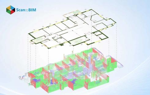
A standard project moves through four stages. Field crews set a terrestrial laser scanner at several positions around a building and log overlapping scans. Drone photogrammetry fills the gaps for roofs, facades, and awkward exterior corners. Software then merges these separate scans into one point cloud through registration. Next, modelers pull the registered point cloud into Revit or ArchiCAD and draw walls, columns, ducts, and equipment straight over the scan. This stage yields a coordinated 3D model that architects, engineers, and contractors pass along across the project. A 10,000 square foot building often needs two to three hours of scanning, plus one day to process into a usable point cloud.
Crews map scan positions ahead of the visit, since gaps between setups leave shadow zones with missing data. Seasoned operators walk the space first and flag columns, stairwells, and mechanical rooms that call for extra positions. Registration software then locks each scan together by matching shared reference points, holding alignment to a few millimeters across a full floor. Once registration wraps, teams run a cleanup pass that strips stray points from moving people, glass reflections, or gear left behind. This prep stage sets the quality of everything downstream, so sharp firms treat field planning as a core piece of success.
Why Reality Capture Is Transforming Architecture
Hand measurements and paper records grow stale within months. A permanent digital record replaces that fragile habit, and teams revisit it at any project stage. Architects on adaptive reuse or heritage renovation gain the most from this change, since original drawings for older buildings rarely match what stands today. Reality capture for architecture closes that gap by anchoring each design choice in verified geometry. Firms that adopt the workflow log fewer surprises once crews reach the site, and design teams spend fewer hours checking dimensions by hand. As-built BIM models carry that same accuracy forward, so owners and facility teams manage a finished building from verified geometry. The method also serves sustainability goals, since teams finish surveys with far fewer return trips and reduced travel.
Key Benefits of Reality Capture for Architects
Architects gain several direct wins from adoption, and each one solves a specific pain point.
- Accurate Existing Conditions: Designers shape additions, retrofits, and interior work around true dimensions, so plans start from measured facts.
- Early Clash Detection: Design teams spot conflicts between fresh mechanical runs and existing structure well ahead of the first pour.
- Stronger Client Confidence: Immersive walkthroughs pulled from the scan help clients trust a proposal early in the project.
- Faster Field Data Collection: 3D laser scanning services trim the hours a survey crew spends on site, since a scanner sweeps a full floor in minutes.
- Organized Digital Models: Point cloud modeling services turn raw scan data into layered models that architects shape right inside their preferred software.
Teams gain trust in every dimension they show a client, a contractor, or a reviewer. That trust carries into faster approvals and fewer disputes once construction opens.
Reality Capture Technologies Used in Architecture
Several distinct technologies sit under the reality capture umbrella. Each one fits a specific site condition, project scale, and accuracy target.
| Technology | Best Suited For | Typical Accuracy |
|---|---|---|
| Terrestrial Laser Scanning | Interior spaces, MEP rooms, complex facades | Millimeter level |
| Mobile Mapping Systems | Large sites, corridors, campuses | Centimeter level |
| Drone LiDAR | Rooftops, facades, site topography | Centimeter level |
| Photogrammetry Software | Smaller objects, heritage detailing | Sub-centimeter to centimeter |
Architects pick a technology mix by project scale, required accuracy, and site access, and many jobs blend two or three methods for full coverage. LiDAR scanning services fuse aerial and ground datasets into one coordinated model that maps an entire property.
Reality Capture and BIM: A Powerful Combination
Scan data reaches full worth once teams link it to Building Information Modeling. A registered point cloud forms the geometric base for a coordinated BIM model. Inside that model, each wall, duct, and structural member echoes true site conditions rather than design intent alone. This pairing cuts the guesswork that surrounds renovation and retrofit work, since modelers draw straight over verified data. Point Cloud to BIM conversion shapes unstructured scan data into a parametric model with tagged elements, material properties, and dimensional accuracy that feeds downstream engineering analysis.
Firms apply this combined workflow to clash detection, quantity takeoffs, facility management, and long-term asset records. A case study in the peer-reviewed tracked BIM adoption across construction projects found that coordinated BIM use cut change orders by 32 percent and lowered requests for information by 25%. The same study reported a 30 percent drop in design errors, which sharpens the financial case for pairing reality capture with a coordinated BIM process.
Common Challenges in Reality Capture Projects
Reality capture provides significant value, but project teams still face a few practical challenges.
- Large File Sizes: Point cloud files swell fast, sometimes hundreds of gigabytes for one large facility, so teams need capable hardware and tidy data habits.
- Registration Errors: Small gaps creep in between scans once field crews skip proper referencing at capture.
- Modeling Time: Turning a point cloud into a usable BIM asset stays a hands-on job, since automated tools handle plain geometry well, though complex mechanical or heritage detailing still asks for a skilled modeler.
- Complex Existing Conditions: Existing condition modeling for older buildings raises the difficulty, since irregular geometry, worn surfaces, and undocumented changes muddy the tracing.
- Weather and Site Access: Wind, rain, and restricted airspace shrink the flight windows for drones on active sites.
- Reflective Surfaces: Glass curtain walls and polished metal scatter laser pulses, so the noisy returns call for manual correction at cleanup.
- Field to Model Coordination: A scan plan drawn apart from the modeling team often skips angles that later prove essential.
Firms who write a clear scope before mobilization, covering deliverable format, level of detail, and accuracy tolerance, dodge costly rescans and hold the schedule from capture through final delivery.
Why Choose ScantoBIM.Online for Reality Capture and Architectural Scan to BIM
ScantoBIM.Online delivers accurate, coordinated models for architecture firms across every project scale. The team blends terrestrial scanning, drone photogrammetry, and skilled modelers to produce dependable, construction-ready output. Clients receive building documentation services that span floor plans, elevations, sections, and MEP layouts drawn straight from verified scan data. Architectural scan to BIM projects run through a structured pipeline of field capture, registration, quality review, and final delivery in the software format a client prefers. An existing building survey from ScantoBIM.Online gives architects a factual starting point for renovation, addition, or compliance work, backed by a team that grasps AEC production schedules. Firms partner with ScantoBIM.Online for projects that call for speed, accuracy, and a modeling team that speaks the language of architects and engineers alike.
Conclusion
Reality capture technology hands architecture firms a factual, current, and detailed record of the buildings they work around. Laser scanning, photogrammetry, and BIM modeling together turn physical spaces into coordinated digital assets that support design, renovation, and facility management. Architects who adopt this workflow trim rework, sharpen client communication, and plan around verified conditions. Adoption keeps climbing across the AEC industry, and the method now stands as a foundational step for any firm that values accurate, efficient, well-documented delivery. The payoff shows up in tighter schedules, clearer coordination, and buildings that match their models on day one.