 +1 (409) 247-5496
 +61 468 036 171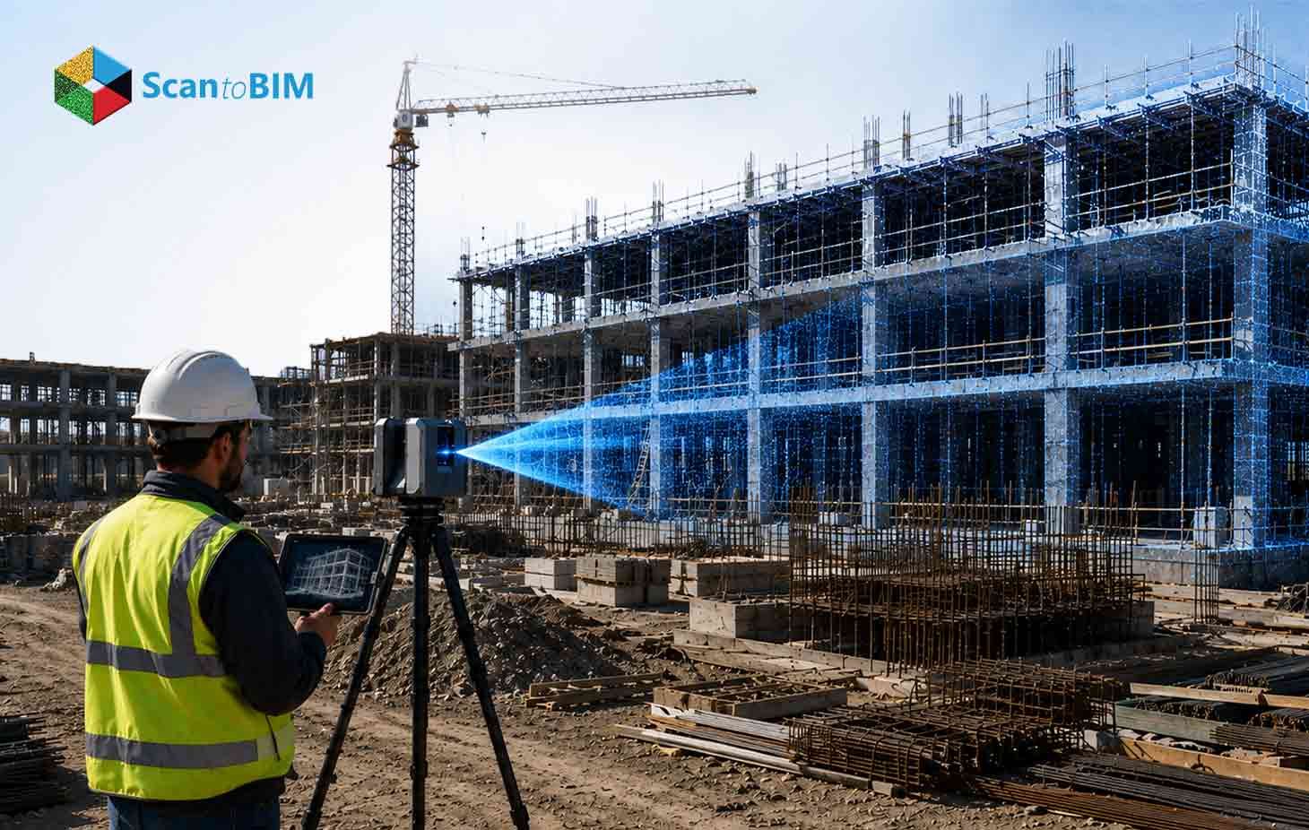
Construction rework drains budgets across every project type. Experts demolish finished work. Fabricators remake costly components. Schedules slip by weeks. Most of this waste starts with inaccurate existing-condition data. Teams design based on assumptions rather than verified measurements. Accurate laser scanning replaces those assumptions with millimeter-grade reality capture.
This article explains how scanning technology prevents rework at its source. It covers the root causes of rework. It walks through the process from capture to delivery. It also guides you toward the right service partner. AEC professionals gain a practical framework for protecting project margins.
What Causes Construction Rework?
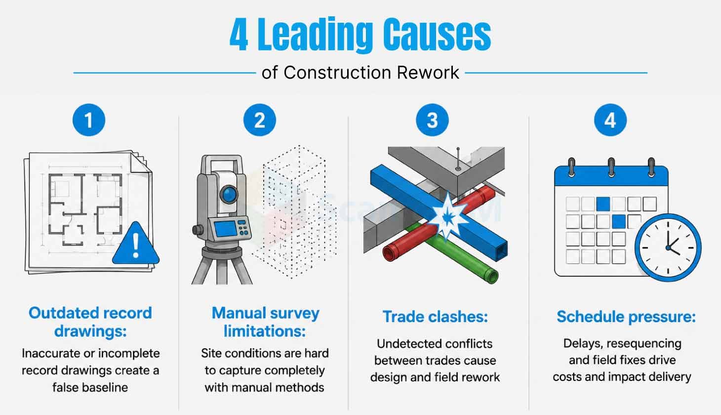
Rework begins long before BIM professionals arrive on site. Four failure points combine to produce most demolition orders. Each one traces back to unverified information about the existing structure.
- Outdated Record Drawings: Design teams often work from record drawings created decades ago. Buildings change over time through undocumented repairs and hidden service routes. Designers then model an imagined structure rather than the real one.
- Manual Survey Limitations: Tape measures capture a limited number of points. Complex geometry defeats handheld methods. Sloped slabs plus deflected beams escape detection until installation fails.
- Trade Clashes: Ductwork meets structural steel in the same corridor zone. Piping occupies space reserved for cable trays. The crew finds the clash on a Tuesday morning with the steel already hung. Everything stops right there.
- Schedule Pressure: Compressed programs push design releases before verification finishes. Procurement orders material based on unchecked dimensions. Each shortcut converts a small data gap into an expensive field failure.
Accurate digital documentation removes each failure point at the source. Verified geometry gives every discipline a shared factual baseline. Teams coordinate around measured truth rather than assumption.
How Accurate Laser Scanning Reduces Construction Rework
Terrestrial scanners emit millions of laser pulses each second. Each pulse returns a measured point in three-dimensional space. The combined output forms a point cloud that mirrors real site conditions. LiDAR scanning for construction also improves site safety because teams capture hazardous zones from a distance. Three mechanisms then convert the captured data into direct rework prevention.
Verified Design Geometry: Captured reality changes design behavior immediately. Every discipline works from measured truth, not from estimated dimensions.
- Architects model against actual wall positions and true floor levels.
- Structural engineers detail connections against the column that actually stands there. The one on the 1987 drawing sits 40 millimeters away.
- MEP designers route services around documented obstructions.
- Prefabricated assemblies arrive on site and fit the first time.
Early Site Verification: Scanning supports accurate renovation planning at the earliest project stage. Each verification below removes a future demolition risk.
- Teams verify floor flatness before layout begins.
- They confirm wall plumbness before facade attachment.
- They document ceiling voids before mechanical design starts.
Proven Financial Impact: The numbers back these findings up. A 2025 case study series in Discover Materials tracked projects that adopted coordinated modeling. Rework costs fell by 40 to 50 percent on those jobs. Accurate scan data feeds the models behind results like these.
Field experience supports the published numbers. Our audit teams review scan registration files on live hospital retrofits. Projects with verified point clouds show clean coordination logs. Projects that skipped scanning show repeated field change requests within the first structural phase. The difference appears in the cost reports every single quarter.
The Role of Point Cloud to BIM in Preventing Rework
Raw scan data delivers full value once it becomes an intelligent model. BIM Modeling from Point Clouds converts registered scans into parametric Revit elements. Modelers trace structure first. Architecture follows. Mechanical systems finalize the design. Each element carries verified coordinates from the field.
Professional point cloud to BIM services then enable true clash prevention with strict quality control. Coordinators load the model into Navisworks. Automated tests flag every collision between disciplines. Engineers resolve conflicts on screen weeks before fabrication. Reviewers also overlay each modeled element onto the source cloud. Elements that are outside tolerance are returned to the modeler for correction. A digital fix costs minutes. A field fix takes days and results in material waste.
Existing building BIM models extend this protection across the asset lifecycle. Facility owners gain a single measured source of truth. Future renovation teams reference verified geometry from day one. Every later project starts with certainty, not survey guesswork.
Benefits of Laser Scanning for Construction Projects
The business case reaches far beyond clash prevention. Modern scanners capture up to two million points per second. Weeks of field time were once consumed by traditional existing building surveys. Scanning compresses that effort into hours. The gains then multiply across every project stage.
- Speed: Project teams receive complete site data within days of capture.
- Accuracy: Survey-grade scanners achieve tolerances within a few millimeters. That resolution reveals slab deflection, wall lean, and every pipe penetration.
- Coordination: Every trade measures from the same point cloud. Disputes shrink because visual evidence replaces verbal recollection.
- Lifecycle documentation: Scan before the drywall goes up, so every hidden pipe stays findable for the long haul. Facility team, thank you a decade later.
- Remote access: Your consultant in another city can walk the site from a laptop. Travel budgets shrink fast.
Cost protection completes the case. A study shows savings of 5-9% during construction. Fewer change orders plus reduced rework produce those savings. Those savings often exceed the total scanning fee by a large margin.
Laser Scanning Workflow for Construction Projects
Step 1: Planning
The project team defines scan scope first. It sets accuracy targets for each building zone. It selects the level of detail for modeled elements. A BIM execution plan records these decisions and assigns clear responsibility for every deliverable.
Step 2: Hardware Selection
Terrestrial scanners deliver the highest accuracy for structural work. Mobile SLAM units cover large interiors at speed. Drone photogrammetry documents roofs plus tall facades safely. Many projects combine platforms for complete coverage.
Step 3: Field Capture
Now the fieldwork starts. A technician sets the scanner on station one. The routine repeats across dozens of stations. Good teams keep generous overlap because thin coverage ruins registration later. Reference targets tie everything together. Teams offering serious 3D laser scanning services photograph the site as they go. Those photos settle arguments later.
Step 4: Registration
Back at the office the real scrutiny begins. Registration software stitches every setup into one coordinate system. Then read the registration report before touching anything else. An alignment error above tolerance sends the crew straight back to the site. Control points tie the whole dataset to the project grid. Only clean data earns a pass to modeling.
Step 5: Modeling
Modeling turns raw points into something a designer can actually use. This is where the laser scan to BIM workflow earns its fee. Modelers build to LOD 200 or LOD 300 depending on the contract. Then comes favorite check of the whole process. Drop the finished model back over the cloud. Gaps between model and points show up instantly.
Step 6: Delivery and Verification
Clients receive the model together with the validation report. Teams import the files directly into their design environment. Repeat scans during construction, then verify installed work against the coordinated model. Construction planning then proceeds on verified ground. Deviations surface within days instead of months.
Common Deliverables from Laser Scanning Projects
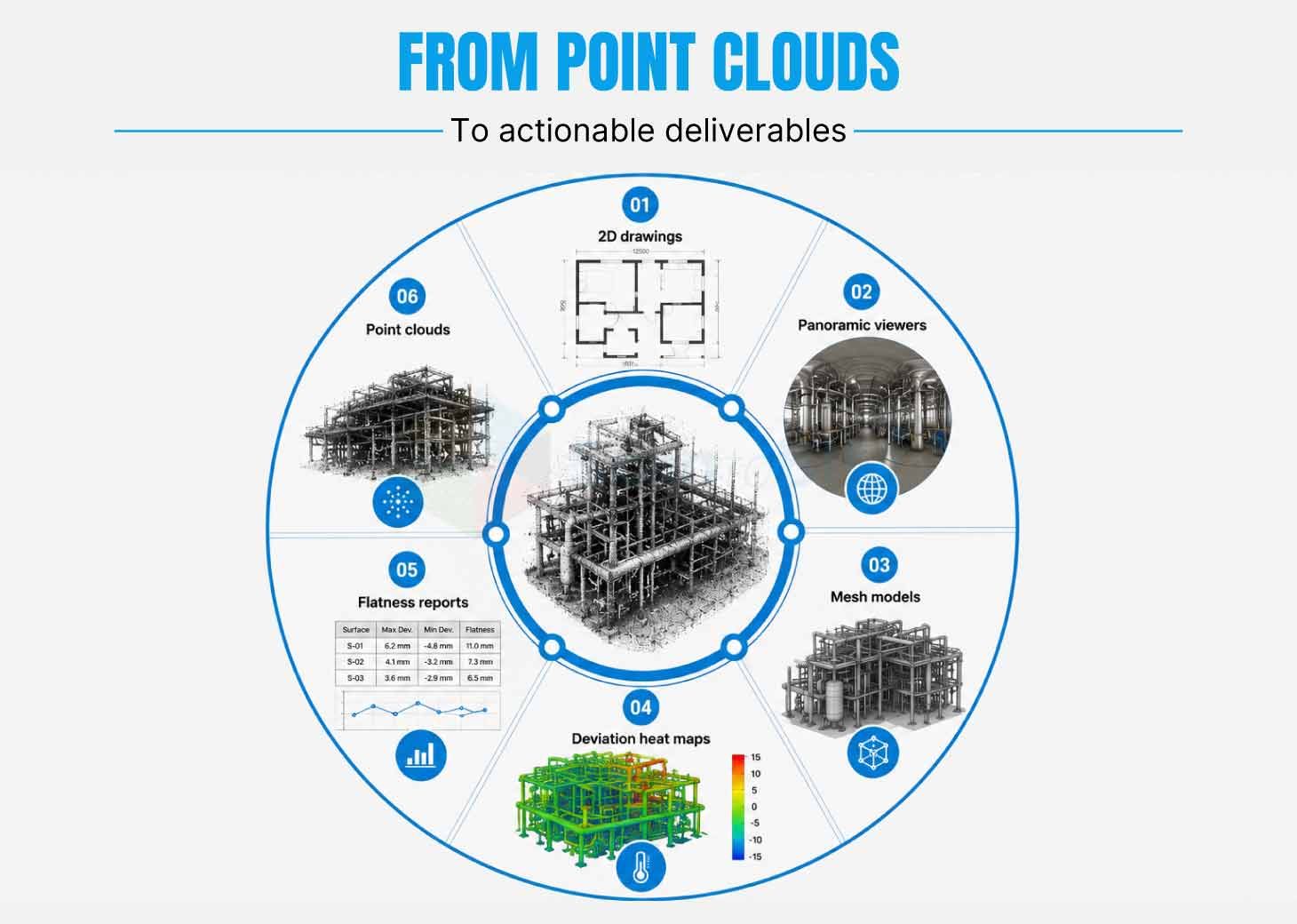
Point cloud files form the base deliverable of every project. Providers supply RCP files for Autodesk platforms. E57 files serve open format needs. Architectural scan to BIM projects add full Revit models with walls, doors, windows, and structural framing. Supporting outputs, then, serve every downstream team.
- 2D drawings: Floor plans come directly from horizontal cloud slices. Sections plus elevations document vertical relationships for permit work.
- Panoramic viewers: Web-hosted platforms let stakeholders walk the site from any browser.
- Mesh models: Rendered surfaces feed visualization pipelines for client presentations.
- Deviation heat maps: Green means built as designed. Red means someone owes an explanation. Site meetings move faster with one on the wall.
- Flatness reports: Certified slab data shows you where an epoxy floor will pond before anyone pours it.
A few niche outputs round things out. Architectural BIM modeling teams produce ornate facade studies for heritage projects. Each deliverable carries verified accuracy from the original capture. Clients select the exact package their project phase requires.
How to Choose the Right Laser Scanning and Scan to BIM Partner
Experience separates capable partners from equipment renters. Review completed projects in your building category. Request sample models with their source point clouds. A qualified Scan to BIM company shares registration reports openly and explains its quality process in clear language.
Then dig into the technical side. Which scanners does the team run? Which national BIM standard governs their models? How do they move your files securely? Push for straight answers on turnaround times too. Here is the advice after years of vendor reviews: run a pilot. Commission a single floor or plant room as a paid trial. Strong pilot results earn the full building.
Conclusion
Rework remains one of the most preventable costs in construction. The pattern behind it stays consistent: teams build from unverified information. Laser scanning breaks that pattern at the source. Captured reality replaces assumption. Coordinated models replace disconnected drawings. Clash resolution moves from the job site to the screen. Projects that adopt this process protect their budgets. They protect their schedules. They protect working relationships too. The technology carries a modest upfront cost. The avoided demolition, refabrication, and delay expenses repay that cost many times over. Verified data forms the strongest foundation any project can stand on.